WebODM Alternatives
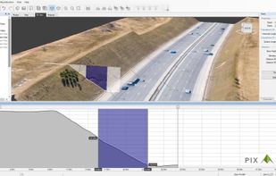
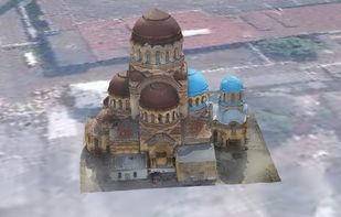
WebODM is described as 'Drone Mapping Software. Generate maps, point clouds, DEMs and 3D models from aerial images. Runs on your computer, even offline. No monthly fees' and is a 3D Modeler in the photos & graphics category. There are more than 25 alternatives to WebODM for a variety of platforms, including Windows, Linux, Web-based, Mac and iPhone apps. The best WebODM alternative is Meshroom, which is both free and Open Source. Other great apps like WebODM are Pix4d, Agisoft Metashape, Regard3D and Scaniverse.
Alternatives list
 12 MicMac alternatives
MicMac is a free open-source (Cecill-B licence) photogrammetric suite that can be used in a variety of 3D reconstruction scenarios. In aims mainly at professionnal or academic users but constant efforts are made to make it more accessible to the general public.


Pixpro is a photogrammetric software targeted at solving surveying challenges and facilitating multiple on-site and off-site work stages.


PhotoModeler photogrammetry software provides image-based modeling, for accurate measurement and 3D models in engineering, architecture, film, forensics, and more! The most cost-effective and affordable way to do accurate 3D scanning, measurement and surveying.
Cost / License
- Paid
- Proprietary
Platforms
- Windows
P
Petro Outlet is a modern fully featured back office application for the convenience industry with two modules. One for independent stations and franchises. The other for brand names and distributors.The application can be accessed on a computer or on-the-go via a Smartphone.
Cost / License
- Freemium
- Proprietary
Platforms
- Online

 16 ImageModeler alternatives
Autodesk® ImageModeler™ image-based modeling and photogrammetry software enables architects, designers, and entertainment content creators to generate 3D models from 2D digital images. The software’s easy-to-learn, three-step workflow—calibration, modeling, and...
Cost / License
- Paid
- Proprietary
Alerts
- Discontinued
Platforms
- Windows


OpenMVS is a library focusing on Multi-View Stereo reconstruction. It aims to fill a gap in the photogrammetry chain-flow by providing algorithms to recover the full surface of the scene to be reconstructed.


 +3
+3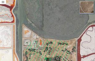


FlytBase platform allows easy deployment of intelligent drones, connected with cloud-based business applications. FlytBase provides drone software which is compatible with all major drones (DJI, 3DR, APM, PX4) and hardware platforms.
Cost / License
- Paid
- Proprietary
Platforms
- Online


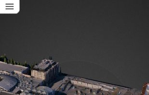
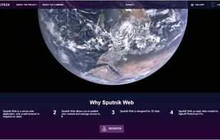
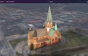
Sputnik Web is a service which opens up new opportunities in the field of online cartography. Create 3D models, publish and share.
Cost / License
- Freemium
- Proprietary
Platforms
- Online


Botlink enables users to fly drones, create aerial maps, and automatically sync those maps with industry software such as Procore, Egnyte, and AgLeader SMS.
 +3
+3


