

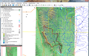
MapWindow is a fully free and open source geographic information system project. It includes an open source programming component, MapWinGIS ActiveX, and an extensible desktop application that supports plug-ins written in .NET (C# and VB.NET).
MapWindow is a fully free and open source geographic information system project. It includes an open source programming component, MapWinGIS ActiveX, and an extensible desktop application that supports plug-ins written in .NET (C# and VB.NET).

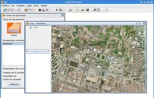
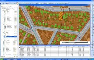
gvSIG is a Geographic Information System (GIS), that is, a desktop application designed for capturing, storing, handling, analyzing and deploying any kind of referenced geographic information in order to solve complex management and planning problems.

MapServer is an Open Source platform for publishing spatial data and interactive mapping applications to the web. Originally developed in the mid-1990’s at the University of Minnesota, MapServer is released under an MIT-style license, and runs on all major platforms (Windows...

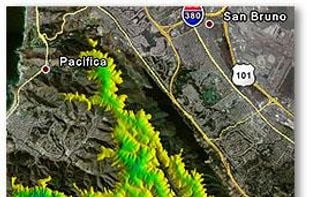
MICRODEM is a freeware microcomputer mapping program written by Professor Peter Guth of the Oceanography Department, U.S. Naval Academy. MICRODEM displays and merges digital elevation models, satellite imagery, scanned maps, vector map data, and GIS databases.

Creating web map applications with Mango is quick and easy. All you need is a web browser and your data.


MapInfo Professional is a powerful, functionally rich desktop mapping application from Pitney Bowes MapInfo, designed to enable organisations to solve business problems that have a geographical element.

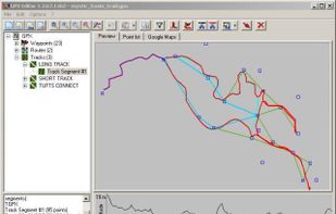
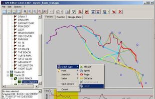
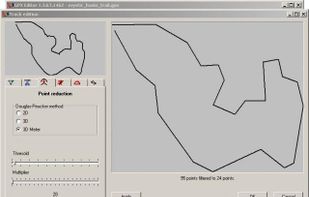
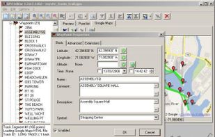
Load, modify and save your GPX 1.1 files. Add and remove waypoints, edit track and routes, simplify tracks (reducing file's size), clean recorded data, add and edit GPX metadata, edit waypoint, route and track properties, all with real-time preview.

The GEOCONCEPT solution was designed first and foremost to respond to expectations of users who wanted to leverage the power of geographical data to the fullest.

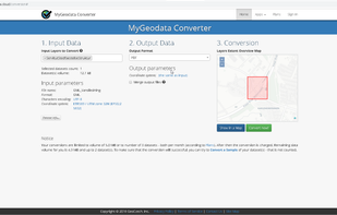
Download shared GIS data or upload your own GIS data, convert them on-line to various GIS/CAD formats and coordinate systems, show your GIS data on a map, share or publish your data.

Whether you need to show your location, study area, service territories, neighborhood, trends, news, or world, Ortelius makes mapping easy.

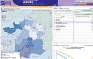
The Géoclip interactive mapping solution is proposed by EMC3. Géoclip permits to publish online thematic atlas or territorial observatories. Géoclip allows you to build web mapping applications for cartographic representations of statistical data.

CADopia is a powerful Computer-Aided-Design software for engineers, architects, designers and drafters — virtually anyone who creates, edits, or views professional drawings.


Manifold GIS is a combination of mapping, CAD, DBMS and image processing. The hallmark of GIS is the power of using a visual interface to view, grab, analyze, manipulate and transform data that would not be comprehensible in classic row and column DBMS text presentations.

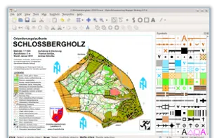
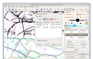
OpenOrienteering Mapper is an orienteering mapmaking program, thought as a free alternative to the existing proprietary solution. Its main advantages compared to it are:

Equator is online mapping software that allows anyone to find, create and publish maps in minutes. One globe, unlimited maps.

MapViewer is an affordable mapping and spatial analysis tool that allows you to easily produce publication-quality thematic maps. Precisely display your data distribution with the most intuitive functions and features.

Beautiful, User Friendly online mapping software that scales to big data.
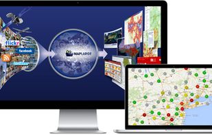
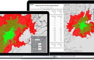
The MapLarge API enables user-driven, low latency, interactive visual exploration and analysis of very large geospatial and non-geospatial data collections to recognize patterns and identify anomalies. Use.

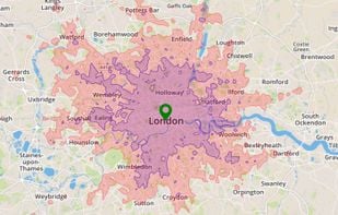
Search, filter and map locations by travel time rather than distance with this API. When added to a location search engine it can search and display results by time and create travel time maps for users. In-depth data analysis also available.

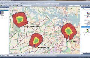
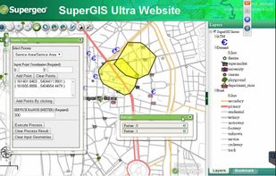
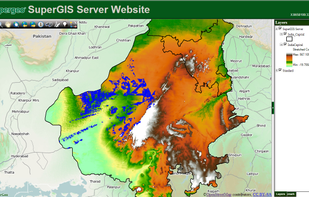
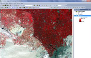
Supergeo Technologies Inc. is global leading GIS software & total solution provider. With series GIS products covering from desktop, mobile, server to developer SDK, SuperGIS has been utilized more than 100 different countries.

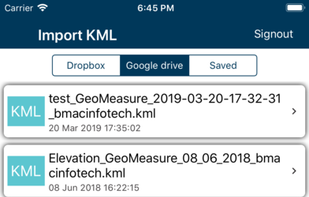
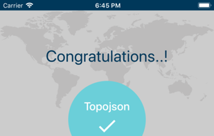
KML to KMZ, Geojson, Topojson, GPX, CSV, converter now available on the app store feel free to download because it's fully free. convert any compatible file format.

H2GIS is a spatial extension of the H2 Database Engine in the spirit of PostGIS . It adds support for managing spatial features and operations including a Geometry constraints, the Open Geospatial Consortium...

Blue Spatial is an ESRI Geoservices REST Implementation. Blue Spatial is a drop in replacement for ArcGIS Server that works with all ESRI API's and ArcGIS Desktop. Blue Spatial was created as an alternative to ArcGIS Server for organizations that have existing investments /...

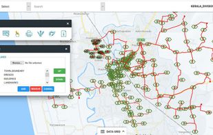
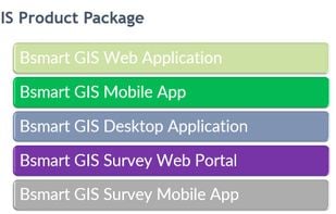
bSmart GIS is a web-based GIS application software. It contains over 350 features and tools that can be used for Geo-spatial data management as well as analysis, image processing. For Electricity, Water, Gas, Telecom and Renewable Energy.

GeoMedia, a comprehensive and dynamic GIS software, extracts compelling intelligence from geospatial data to present actionable information.

Spatial Feature Server by MapET is an ESRI Geoservices REST Implementation and works with all ESRI Rest API's. The source of published data is the spatial extension of the major RDBMS, such Oracle, Microsoft SQLServer, MySQL, PostgreSQL.


