Apps tagged with 'Point Cloud'

All apps in Apps tagged with 'Point Cloud' category. Use the filters below to narrow down your search. 
Copy a direct link to this comment to your clipboard
  1. MeshLab icon
     50 likes

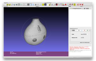
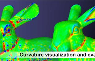
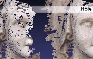
    System for processing and editing 3D triangular meshes, provides a set of tools for editing, cleaning, healing, inspecting, rendering, texturing and converting meshes.

    Cost / License

    Application type

    Platforms

    • Mac
    • Windows
    • Linux
    • IT flagItaly
    • European Union flagEU
    Main UI
    Testing MeshLab's paint tool
    MeshLab screenshot 2
    +11
    MeshLab screenshot 3
    21 alternatives
  2. Autodesk ReCap Pro is a software tool for creating 3D models for real-world infrastructure projects. It allows designers and engineers to capture detailed models of real-world assets and supports Building Information Modeling (BIM) processes.

    Cost / License

    • Paid
    • Proprietary

    Platforms

    • Windows
    • US flagUnited States
    Autodesk ReCap screenshot 1
    Autodesk ReCap screenshot 1
    12 alternatives
  3. 3DViewer icon
     1 like

    Outstanding features of 3DViewer are its high-speed visualization, its versatile 3D data display capabilities and its DCOM interface, which allows users access to 3DViewer from other programs. Data Exchange:

    Cost / License

    • Free
    • Proprietary

    Platforms

    • Windows
    • DE flagGermany
    • European Union flagEU
    3DViewer screenshot 1
    5 alternatives
  4. Pointshop3D icon
     2 likes

    Pointshop3D is a system for interactive shape and appearance editing of 3D point-sampled geometry. By generalizing conventional 2D pixel editors, it supports a great variety of different interaction techniques to alter shape and appearance of 3D point models, including cleaning...

    Cost / License

    • Free
    • Proprietary

    Application type

    Platforms

    • Windows
    • Linux
    • CH flagSwitzerland
    Pointshop3D screenshot 1
    42 alternatives
  5. xeoVision icon
     1 like

    xeoVision is a fast, browser-based 3D BIM viewer built with xeokit SDK. Viewing multiple 3D models and formats at once per drag & drop from your browser on PC & mobile!.

    Cost / License

    Platforms

    • Online
    • LI flagLiechtenstein
    Exploring your models made simple. Search for properties, create section views, precise measurements and add annotations to share with your stakeholders.
    Information extracted from BIM model

Focus on the data within the BIM model. Easily get .db (SQLite) file or a .json file separated from the geometry for further processing. Check out also the log files for performance and quality assurance.
    xeoServices - Developer portal

As a software developer you can check out xeoServices that power xeoVision - https://docs.xeo.vision/. Get an access token and play with the interactive developer portal. Ready-to-use IDS validation, IFC model check, IFC conversion to different other formats, etc.
    +1
    Multiple models & formats with real-world coordinates & double precision

Check out and compare multiple models & formats. Benefit from geo-referencing, double precision & real-world coordinates (powered by xeokit SDK).
    9 alternatives
  6. 3D Reshaper icon
     1 like

    Point cloud process, 3D Meshing, CAD surface reconstruction, dental CAD and tridimensional comparison. Feature Line extraction, Tunnel cross-sections, Eliminating measurement noise, Registration, cloud alignments.

    Cost / License

    • Paid
    • Proprietary

    Platforms

    • Windows
    • SE flagSweden
    • European Union flagEU
    3D Reshaper screenshot 1
    3D Reshaper screenshot 1
    3D Reshaper screenshot 2
    +5
    3D Reshaper screenshot 3
    6 alternatives
  7. xeokit SDK icon
     1 like

    3D BIM IFC Viewer SDK for AEC engineering applications. Open Source JavaScript Toolkit based on pure WebGL for top performance, real-world coordinates and full double precision.

    Cost / License

    Platforms

    • Self-Hosted
    • JavaScript
    • npm
    3D zones created by the user with labels and info
    BCF Viewports for IFC models with section views, 2D overlay, minimap and more
    Bundled xeokit BIM viewer as a sample project
    +2
    Rendering point clouds, 3D Lidar scans, photogrammetry
    8 alternatives
  8. Leica Geosystems HDS™ Cyclone is the market leading point cloud registration software. It provides “Survey-Grade” tools for automatic and manually registering, geo-referencing, analysing and reporting on point cloud data.

    Cost / License

    • Paid
    • Proprietary

    Platforms

    • Windows
  9. f360Vision is a free viewer for 3D point clouds, with or without panoramic photos. Use it directly in your browser with no installation, as a desktop app for Windows and macOS, or self-host it via Docker on your own server or cloud for full data control.

    Cost / License

    • Freemium
    • Proprietary

    Platforms

    • Online
    • Windows
    • Mac
    • DE flagGermany
    • European Union flagEU
    360 demo view
    3 alternatives
  10. Cyclone BASIC is a powerful yet affordable module providing basic utility functionality such as 3D point cloud visualisation, measurement, markup, and data exchange software for professionals. It also provides scanner control operations for older Leica Geosystems scanners.

    Cost / License

    • Paid
    • Proprietary

    Platforms

    • Windows
  11. 360ForYou icon
     Like

    Browser-based viewer for virtual tours, point clouds, 3D Gaussian splats, BIM models, 360° video, PDFs and GeoTIFF maps.

    Cost / License

    • Freemium
    • Proprietary

    Platforms

    • Online
    • Software as a Service (SaaS)
    • Self-Hosted
    • DE flagGermany
    • European Union flagEU
    Virtual tours
    Point clouds
    Meshes
    +5
    3D Gaussian Splatting
    6 alternatives
  12. Convert LiDAR point clouds into detailed Revit terrain in seconds — process LAS/LAZ ground data into Toposolid/TopoSurface with density control, coordinate offsets, multi-core speed and CSV export.

    Cost / License

    • Paid
    • Proprietary

    Platforms

    • Windows
    7 alternatives
  13. Swyvl icon
     Like

    Spatial data platform for surveyors and drone users to upload and organize point clouds, orthomosaics, 3D models, and media, then share instantly in-browser.

    Cost / License

    • Freemium
    • Proprietary

    Platforms

    • Online
    • Software as a Service (SaaS)
    • AU flagAustralia
    A survey site with point clouds, Gaussian splats, documents and 360 captures organised by collection and capture date
    An E57 laser scan streaming in the built-in Potree point cloud viewer with measurement tools — no CAD software needed
    A drone orthomosaic (GeoTIFF) displayed in place on the site map
    +3
    Every capture location plotted on the site overview map
    3 alternatives
  14. Share and view inspection results and a multitude of 3D scan data and CAD formats with Geomagic Verify Viewer. This free viewer application, based on Geomagic Verify, lets anyone view the results of inspections created in Verify, including deviation color maps, dimensions and...

    Cost / License

    • Free
    • Proprietary

    Alerts

    • Discontinued

    Platforms

    • Windows
    • US flagUnited States
    Geomagic Verify Viewer screenshot 1
    6 alternatives