Map a run, walk, or ride from your phone, tablet, or PC. Save to Google Drive, view elevation profiles, share a link, export as gpx, or embed in a website.
Cost / License
- Free
- Proprietary
Platforms
- Online
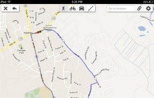

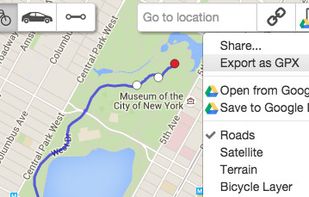
Map a run, walk, or ride from your phone, tablet, or PC. Save to Google Drive, view elevation profiles, share a link, export as gpx, or embed in a website.


Location based restaurant food price, food rating & distance comparison and navigation by car, on foot, transit and bike in 41 countries. Just write hamburger, share/pin your location and list all hamburgers around; compare, select one and navigate.


PlanePlotter receives and decodes live digital position reports from aircraft and plots them on a chart. You can see a radar-like display of all those aircraft around you broadcasting digital messages including ACARS, ADS-B and HFDL.


Fast, private, and minimalist maps designed for you. Heexy Maps offers a no-tracking, privacy-first alternative for everyday navigation and exploration.


CyclOSM is an OpenStreetMap cycle-oriented render. Contrary to OpenCycleMap, this render is free and open-source software and aims at being more complete to take into account a wider diversity of cycling habits.


Chronas is a history map application with over 50 million data points which every registered user can curate and contribute to (just like Wikipedia).

The reference implementation of the Open Geospatial Consortiums WFS and WMS services, GeoServer is a full featured open source software server written in Java that allows users to query, visualize, combine, edit and publish spatial data over the web.
A private, free and open source replacement for Google Maps and other geocoding services that relies on Photon, which you can run on your own server. It uses the Photon API to fetch results to your phone, allowing you to search for places in...
MAPOG is an AI-powered interactive mapping platform that lets users create map-based stories, add images, videos, links, and details to pins, manage tasks, collect field data, sort locations by live position, and share or embed maps.


QLandkarte GT is a powerful Open Source GIS application to display your GPS data on a variety of maps. It's target is the less the scientific user but the private outdoor aficionado


Service Mapny designer allows you to create a map anywhere in the world. Interior, geographical, maps of the sky of the highest quality


Mapme is a no-code interactive map builder that lets anyone create beautiful, fully branded maps in minutes — no coding or GIS knowledge required.


Trail Explorer is a website and a mobile app to explore any location on the map, discover nearby hiking trails and places of interest, explore outdoor sports opportunities, ChatGPT advice and insights, videos, webcams, the weather, news across 20 categories.


Online maps for web, mobile apps and desktop software. You can change colors, add or remove particular map elements or enhance the map with own geodata.


The Headway Project was born out of a frustration with the need to send current and future location data to a corporation in order to figure out how we’re getting from A to B. Offline-only maps apps can be frustrating to use, and sometimes suffer from performance problems, poor...


Make high-dpi maps for print applications within minutes, using the Printmaps editor. Put custom geo data such as routes or shapes onto your map, or geocode hundreds of addresses to populate your map with POIs.
Find your way around the city and keep track of current traffic with your cell phone.


GIS Cloud is a complete Online Mapping Solution for:


MapTiler is graphical application for online map publishing. Your map can create overlay of standard maps like Google Maps, Yahoo Maps, Microsoft VirtualEarth or OpenStreetMap and can be also visualized in 3D form by Google Earth.

Stats about all US cities - real estate, relocation info, house prices, home value estimator, recent sales, maps, race, income, photos, education, crime, weather, houses, etc.

OpenNauticalChart offers free seacharts for everybody. This charts are usable (offline) with several ship-plotters and Navigation-equipement on board.

OpenSeaMap's goal is to add nautical and tourism information a sailor could be interested in to OSM (OpenStreetMap) and to present it in a pleasing way.