




OsmAnd
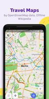
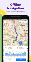
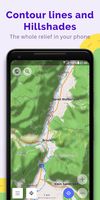
Navigation app offering offline and online OSM-based maps, turn-by-turn voice direction, driving, cycling, and walking modes, POI search, GPX track management, map overlays, monthly map updates by country or region, speed and safety features, and location sharing.



Cost / License
- Freemium (Pay once)
- Open Source
Application typeApplication types
 EU
EUPlatforms
- Mac
- Online
- Android
- iPhone
- Chrome OS
- Android Tablet
- HUAWEI AppGallery
- iPad
- Android Auto
- F-Droid
- Kindle Fire
- Apple Car Play
- OpenAPK

Features


OsmAnd News & Activities
Recent News
- POX published news article about OsmAnd
 OsmAnd 5.3 for Android adds astronomy plugin, 3D buildings, globe view, new widgets & more
OsmAnd 5.3 brings several key enhancements to its Android app, anchored by the introduction of an a...
- Fla published news article about OsmAnd
 OsmAnd 5.1 for Android and iOS expands cross-platform purchases and brings new features
OsmAnd, celebrating 15 years, has released version 5.1 for Android and iOS. The update introduces w...


Recent activities
- magicscraper liked OsmAnd
 antti97b added OsmAnd as alternative to GPS Logger
 coth added OsmAnd as alternative to 2GIS, Yandex Maps and Yandex.Navigator
- c17s5qhu updated OsmAnd
- Raposu liked OsmAnd
- neversad liked OsmAnd
- bearygarcia liked OsmAnd
 coth added OsmAnd as alternative to Navitel Navigator GPS & Maps


Featured in Lists

## WHAT IS F-DROID ? F-Droid is an awesome app repository for FOSS (Free & Open Source Software) android apps....

A list of interesting and open source [Android](/software/android/) apps.

Everytime I setup a phone for a friend or myself I usually remove stock apps using adb or...



What is OsmAnd?
OsmAnd Videos
OsmAnd information
Developed by
 OsmAND B.V.
 Licensing
Open Source and Freemium product.Pricing
One time purchase (perpetual license) that costs $40 + free version with limited functionality.Written in
Rating
Average rating of 4.3Alternatives
111 alternatives listedBadge
Get an embeddable badge for OsmAndSupported Languages

AlternativeTo Categories
Travel & Location, Sport & Health, Online ServicesApple AppStore
- Updated
- 4.6 avg rating
GitHub repository
- 6,023 Stars
- 1,231 Forks
- 3550 Open Issues
- Updated


Comments and Reviews
OSMAnd is the go-to maps app on Android for Open Street Map navigation. I use it frequently, as I don't use any Google products. The ability to download maps for offline use is also invaluable, as oftentimes I will be in an area I don't get service, and can still easily navigate where I need to without any stress.
Has a lot of features but can take some time getting used to, many settings that should be on the front ui are instead buried behind setting tabs (like weather data).
Unfortunately has a terrible rendering engine which in my case constantly unloads and reloads things as you pan/zoom about, which wouldn't be a problem if it didn't take so long for things to load in the first place, making it very irritating to use.
Despite all the multifunctionality and flexibility in settings, the application does not allow taking into account the traffic intensity (current and planned) when plotting a route. That is, it is absolutely not suitable for car navigation in cities. Unfortunately.
Has a wide range of features, customization, advanced search. But I experience some flaws that the user need to understand the app well in order to have a smooth experience.
terrible name that's impossible to remember, shockingly good user experience. Starts off as an average-sized app but it lets you download offline map information divided by city, usually 100mb each. The UI isn't frustrating or difficult to see in an unobscured state like google maps is. Also lets you bookmark locations which is just staggeringly convenient.
THE most powerful mapping and navigation app, full stop. Whatever you want, it has got you, and then some. Yet easy to use. … Also completely offline, no data kraken. In my area, literally every park bench and trash can and forest footpath is in it and my city officially uses and supports it. (For Streetview, integration check out Mapillary.) You can even configure how hilly you want your bike rides to be, overlay maps, change almost everything, and since it is open source, pretty much everything is free. In comparison, Google misses a crazy amount of details, and is often plain wrong, and fails as soon as you’re offline. Once you go OSMAnd, you never go back.
I was actually shocked at how good this app is. Pay the money and enjoy something as good as, and sometimes even better than Google Maps. Love it!