
Menu bar app for macOS enabling real-time flight tracking with live status updates, interactive maps, customizable display, and discreet notifications.
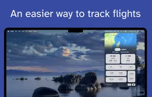
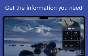
Menu bar app for macOS enabling real-time flight tracking with live status updates, interactive maps, customizable display, and discreet notifications.

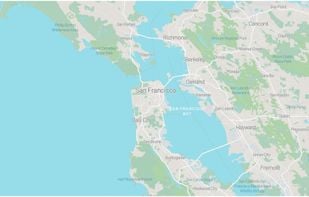
FacilMap is a privacy-friendly, open-source versatile online map that combines different services based on OpenStreetMap and makes it easy to find places, plan trips and add markers, lines and routes to custom maps with live collaboration.


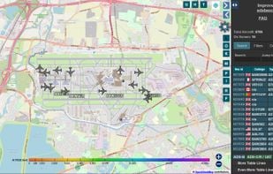
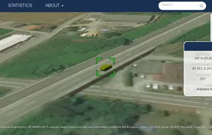
The world’s largest co-op of ADS-B/Mode S/MLAT feeders, and the world’s largest public source of unfiltered flight data. Access to worldwide flight tracking data for hobbyists, researchers, and journalists alike.

Start & Enjoy your travel experience with Hotels.com. The Hotels.com app provides you the best interactive hotel booking experience using all your smartphone’s great features.


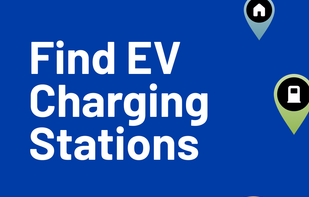
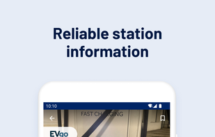
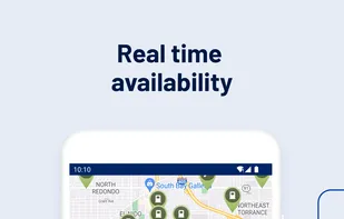
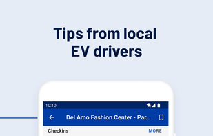
Comprehensive database for EV charging stations, with reviews and photos. Features worldwide network information, filters, navigation links, and payment options.

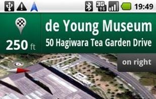
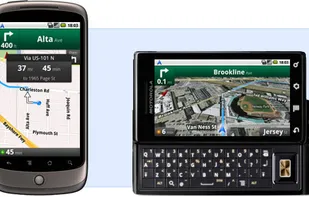
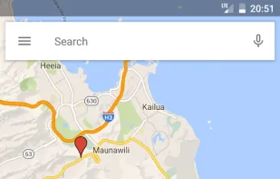
Google Maps Navigation is an internet-connected GPS navigation system with voice guidance.


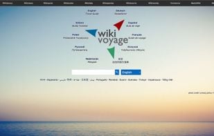
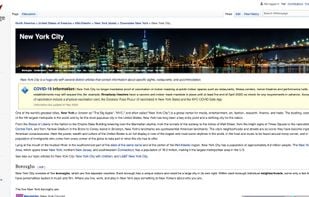
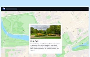
Wikivoyage is a free web-based travel guide for travel destinations and travel topics written by volunteer authors. It is a sister project of Wikipedia and supported and hosted by the same non-profit Wikimedia Foundation.


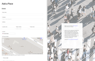
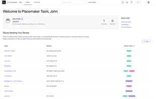
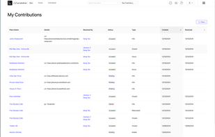
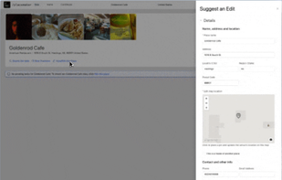
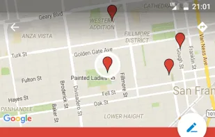
Platform for community contribution and management of location-based experiences, enabling users to enhance shared place data, reach tiered levels, and support developer tools.

Protomaps is an open source map of the world, deployable as a single static file on cloud storage.

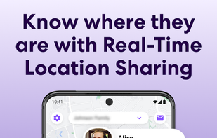
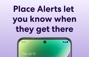
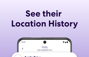
Easily and privately stay connected with loved ones with invite-only circles that let you share locations and get notified of changes.


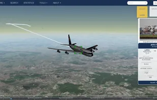
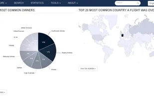
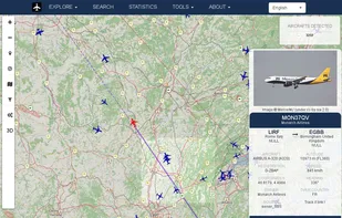
Open source project displaying aircrafts, vessels and gps trackers on a map. Browse through the data based on a particular aircraft, airline,airport, owner, vessel or tracker to search through the database or see extensive statistics.

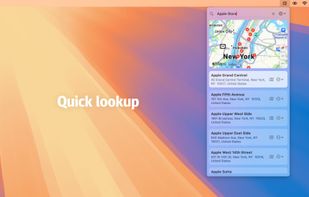
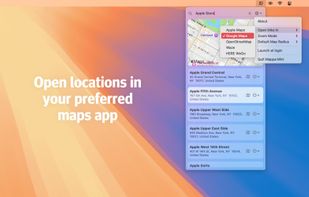
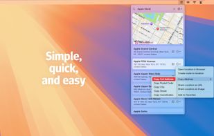
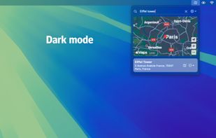
Quickly search for locations directly from your Mac’s menu bar and open them in Apple Maps, Google Maps, or OpenStreetMap.

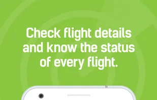
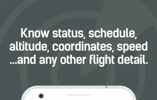
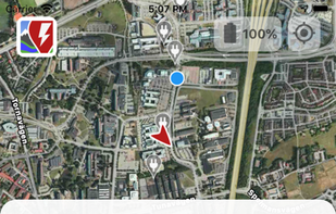
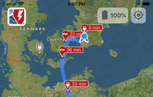
Real-time flight tracking app with one of the best and most accurate coverage worldwide. Download the app for free and know the exact current position of every plane in the sky in real-time!.


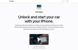
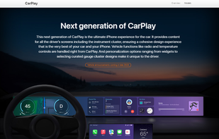
Apple CarPlay is a smarter, safer way to use your iPhone in the car. Just plug in your iPhone and go.


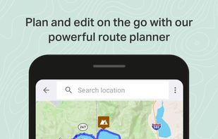
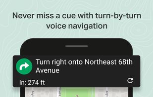
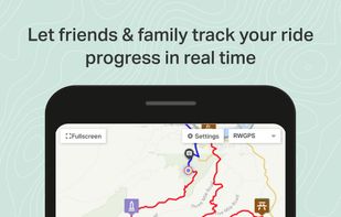
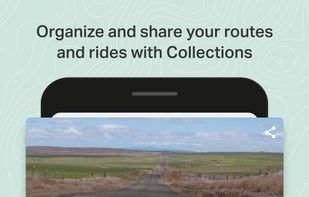
Ride with GPS is the best bike route planner, turn-by-turn voice navigation, and tracking app for cyclists, runners, and hikers. Get the best bike computer and activity tracker available, to plan, navigate, track, record, and share your activities.

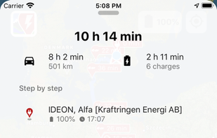
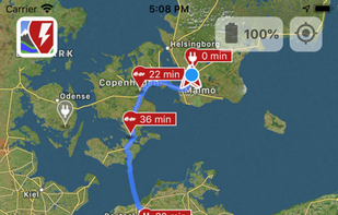
A Better Routeplanner (ABRP) is the world's most respected service to plan, learn and dream about Electric Vehicles - EVs. Simply select your vehicle model, enter your destination and hit plan to get a full trip plan including charge stops and trip duration.

Get food delivery to your doorstep from thousands of amazing local and national restaurants. Find the meal you crave and order food from restaurants easily with the Uber Eats app. Track your order in real-time.


OpenTopoMap is a free topographic map generated from OpenStreetMap and SRTM data. The map style is based on official maps and focuses on good readability through high contrast and balanced signatures.

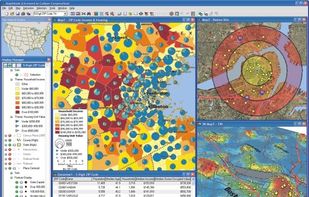
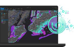
ArcGIS offers unique capabilities and flexible licensing for applying location-based analytics to your business practices.

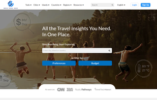
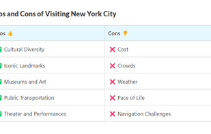
Prepare your journey to any place with World Travel Index now. Learn everything about costs, attractions, safety, and infrastructure of your travel destination.

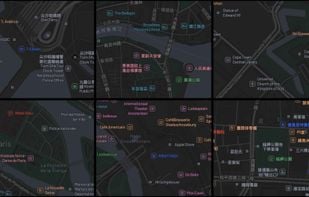
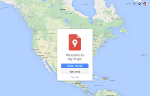
Create custom maps to share and publish online with Google My Maps. You can make maps that show different kinds of information.

Swarm is the easiest way to keep track of the places you go: check-in to remember your favorite places, discover new spots, and stay connected with friends.


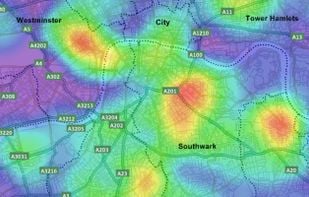
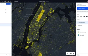
The new standard for GIS software. Simple and powerful. Step into Atlas to explore, analyze and share geospatial data.

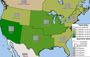
Business mapping software (geographic information system) that delivers affordable, easy-to-use, professional mapping tools for mapping in these sectors: franchising, health care, business, territories, site selection, sales, marketing, banking, more.