Google Maps Alternatives
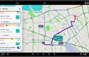
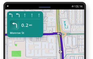
Google Maps is described as 'Navigate efficiently with real-time traffic updates, turn-by-turn GPS, panoramic street views, and comprehensive route planning for multiple platforms' and is a leading GPS Navigation service in the travel & location category. There are more than 100 alternatives to Google Maps for a variety of platforms, including Web-based, Android, iPhone, iPad and Android Tablet apps. The best Google Maps alternative is OpenStreetMap, which is both free and Open Source. Other great apps like Google Maps are OsmAnd, CoMaps, Organic Maps and Waze.
filter to find the best alternatives
Google Maps alternatives are mainly Map Services, but if you're looking for GPS Navigation Services or Travel Planners you can filter on that. Other popular filters include Open Source, Linux, Android, EU, Online + Free, Windows + Free and Free. You can also filter by region, for example EU-based alternatives if you prefer software developed in the European Union. These are just examples - use the filter bar below to find more specific alternatives to Google Maps.
Alternatives list


Transportia is a modern travel companion designed to make public transportation easier and more accessible.
Cost / License
- Free
- Open Source (GPL-3.0)
Platforms
- Android
- F-Droid


 +2
+2


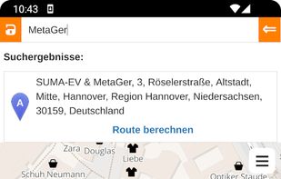
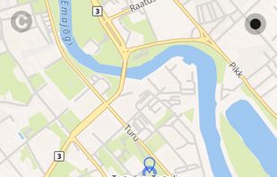
Privacy-focused online map service using OpenStreetMap data, offers daily-updated maps, anonymous browsing, place and POI search, step-by-step navigation for walking, cycling, driving, route exporting, web search integration, multi-language support, and no ads.
Cost / License
- Free
- Open Source
Application types
Platforms
- Online
- Android
- Android Tablet
 +1
+1


Pure Maps is a full-featured map and navigation application allowing you to explore maps, search for addresses and points of interest, as well as assist with navigation.
Cost / License
- Free
- Open Source (GPL-3.0)
Application types
Platforms
- Linux Mobile
- Ubuntu Touch
- Sailfish OS

 +6
+6


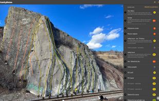
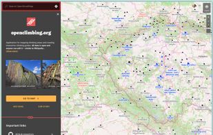
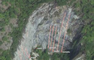
Application for mapping climbing areas and creating interactive climbing guides. All data is open and anyone can edit it – similar to Wikipedia.
 +3
+3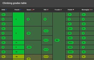

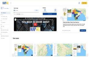
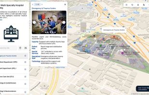
 16 MAPOG alternatives
MAPOG is an AI-powered interactive mapping platform that lets users create map-based stories, add images, videos, links, and details to pins, manage tasks, collect field data, sort locations by live position, and share or embed maps.
 +9
+9

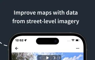
 19 Mapillary alternatives
Collaborative mapping platform generates street-level imagery from user-contributed photos, applying computer vision for privacy, urban planning, mapping, transport, and geospatial enrichment. Integrates with mapping tools and covers over 190 countries globally.

 +1
+1

 47 iGO Navigation alternatives
GPS app featuring offline navigation across 100+ countries with compact storage usage, quick route calculation, 3D city maps, POIs, hands-free directions, and junction view for clarity on major roads, making it ideal for travelers seeking reliable, distraction-free guidance.
Cost / License
- Paid
- Proprietary
Application type
Platforms
- Android
- iPhone
- iPad
- Android Tablet


 +3
+3

 51 Scout by Telenav alternatives
Offers turn-by-turn GPS voice navigation, live traffic updates, customizable routing, group chat, real-time location and ETA sharing, commute alerts, meet-up planning, pit stop features, access to local amenities, hands-free operation, and privacy controls for location sharing.
 +1
+1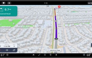

 25 TravelTime API alternatives
Search, filter and map locations by travel time rather than distance with this API. When added to a location search engine it can search and display results by time and create travel time maps for users. In-depth data analysis also available.
Cost / License
- Paid
- Proprietary
Platforms
- Mac
- Windows
- Linux
- Online
- iPhone
- Chrome OS
- iPad
- Apple TV