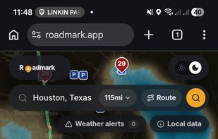

Vetted US truck repair shops, parking, weigh stations, CAT scales, and weather radar on a free map, with roadside help and fleet management features.
Cost / License
- Free
- Proprietary
Application typeApplication types
Platforms
- Online
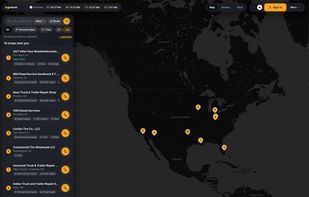



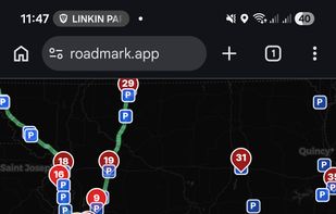
Vetted US truck repair shops, parking, weigh stations, CAT scales, and weather radar on a free map, with roadside help and fleet management features.


LocoMap is a privacy-focused, simple alternative to Google Maps. Create custom maps, save and organize your favorite places, and share them effortlessly with friends.


Map Maker is a powerful but easy-to-use Web application for creating custom maps. You can upload your data, customize how the data is visualized, then export the map or share it with others for editing.

Offline maps with monthly updates, turn-by-turn and voice navigation, real-time GPS tracking, fast multilingual search, millions of POI, and map downloads.


Supergeo Technologies Inc. is global leading GIS software & total solution provider. With series GIS products covering from desktop, mobile, server to developer SDK, SuperGIS has been utilized more than 100 different countries.


PeakVisor will make you a superhero of outdoor navigation by putting state-of-the-art 3D maps and mountain identification magic wand in your hand.


SeeClickFix encouraging residents to become active citizens in taking care of and improving their city by reporting non-emergency issue in their neighborhood.

Sidekick notifies you of road hazards ahead in real time, based on your location, direction of travel and events from multiple data sources. Hands-free. Eyes-free. Touchscreen not required.


Access street-level imagery and map data from all over the world. Fill in the gaps by requesting new coverage or capturing your own!


H2GIS is a spatial extension of the H2 Database Engine in the spirit of PostGIS . It adds support for managing spatial features and operations including a Geometry constraints, the Open Geospatial Consortium...
Equator is online mapping software that allows anyone to find, create and publish maps in minutes. One globe, unlimited maps.


Mapotic is an innovative cloud platform that offers a wide range of map-based products and services to organizations globally, enabling them to effectively leverage the full potential of geolocation data.


TravelMap is a blogging platform that lets travellers create their blog centered on a one-page interactive map.


Pineqone has destination guides for the entire world, a huge database of sights and attractions, and a Planner Tool which allows travelers to easily plan and budget their trips.


KML to KMZ, Geojson, Topojson, GPX, CSV, converter now available on the app store feel free to download because it's fully free. convert any compatible file format.


Waypointer is a service for POI (GPS coordinates) search and management. It will be useful for tourists and owners of GPS devices. With help of Waypointer you can find POIs on map filtered by categories (i.e. spring or camping sites), and prepare your next journey. Also you can e.

The TomTom Maps APIs allow you to easily build location-aware applications. A variety of cross platform REST APIs and SDKs are available to build and enhance your mobile and web apps with search, routing, mapping, traffic and navigation features.
e-Logbook is a free interactive online GPS / IGC track viewer. It allows you to visualize a GPS / IGC track on an interactive 2D topographic map with flight analysis features.


Compare sizes of geographic areas by drawing a polygon on a map and overlaying it onto another part of the world. Also supports drawing paths and rotating the shape on the target map.

A lightweight, private, and fully customizable map app based on OpenStreetMap. Change your perspective, plan routes, explore areas in 3D, and export views without tracking.


OpenStreetMap based POI search tool (supports multiple criteria), POI download, search project reuse, etc. Can be used in market analysis and area research.
Privacy-focused location APIs delivering map tiles, geocoding, and routing, with transparent usage-based pricing, open standards, and engineering-led support.