Apps with 'Mapping' feature Page 4 of 9

All apps in Apps with 'Mapping' feature category. Use the filters below to narrow down your search. 
Copy a direct link to this comment to your clipboard
  1. SkyVector icon
     1 like

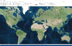
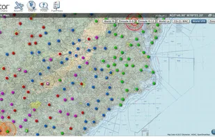
    SkyVector is the most popular flight planner to view aeronautical charts online. Always current, and always free, FAA Sectional Charts are used for VFR flight planning anywhere in ths US. Terminal Area Charts cover only areas around major Class B Airports.

    Cost / License

    • Free
    • Proprietary

    Platforms

    • Online
    SkyVector screenshot 1
    1 alternatives
  2. Sharemap icon
     3 likes

    Sharemap is an online map creation GIS tool. With ShareMap you can create maps that can be later presented in various formats - as SVG vector graphic, bitmap raster or as interactive web map. Maps are free and licensed with Creative Commons license - it can be used on commercial...

    Cost / License

    • Free
    • Proprietary

    Application type

    Platforms

    • Online
    Sharemap screenshot 1
    Sharemap screenshot 1
    Sharemap screenshot 2
    +1
    Sharemap screenshot 3
    22 alternatives
  3.  3 likes

    Create a map of connections based on famous people listed on the Notable Names Database. Learn if they have any connections from dating to political campaigns, and more

    Cost / License

    • Free
    • Open Source

    Platforms

    • Online
    4 alternatives
  4. Play Munzee icon
     5 likes

    Track down QR Codes hidden in the real world and capture them for points. Whether you are a casual player, an avid explorer, or a hardcore competition enthusiast, Munzee helps you rediscover the world around you.

    Cost / License

    • Freemium
    • Proprietary

    Application type

    Platforms

    • Online
    • Android
    • iPhone
    Play Munzee screenshot 1
    Play Munzee screenshot 1
    Play Munzee screenshot 2
    +1
    Play Munzee screenshot 3
    15 alternatives
  5. OSM Tasking Manager is a mapping tool designed and built for the Humanitarian OSM Team collaborative mapping. The purpose of the tool is to divide up a mapping job into smaller tasks that can be completed rapidly.

    Cost / License

    • Free
    • Open Source

    Platforms

    • Online
    • OpenStreetMap
    2 alternatives
  6. MapWindow GIS icon
     6 likes

    MapWindow is a fully free and open source geographic information system project. It includes an open source programming component, MapWinGIS ActiveX, and an extensible desktop application that supports plug-ins written in .NET (C# and VB.NET).

    Cost / License

    • Free
    • Open Source

    Application type

    Platforms

    • Windows
    Main UI
    20 alternatives
  7. Pixel Map Generator lets you play with different projections of a map of the world. You can annotate it, colour in different countries, draw lines on it. You can also zoom in to view countries in more detail.

    Cost / License

    • Free
    • Proprietary

    Application type

    Platforms

    • Online
    Pixel Map Generator screenshot 1
    16 alternatives
  8. Project Sunroof is a solar calculator from Google that helps you map your roof's solar savings potential. Learn more, get an estimate and connect with providers.

    Cost / License

    • Free
    • Proprietary

    Platforms

    • Online
    Project Sunroof screenshot 1
    Project Sunroof screenshot 1
    Project Sunroof screenshot 2
    +2
    Project Sunroof screenshot 3
  9. iCaching icon
     3 likes

    iCaching is the all-in-one Geocache manager for the Mac. It is a fast, native app with a real Mac userinterface like you’re used to from applications like iTunes. Available in the Mac App Store.

    Cost / License

    • Paid
    • Proprietary

    Application type

    Platforms

    • Mac
    iCaching screenshot 1
    iCaching screenshot 1
    iCaching screenshot 2
    +2
    iCaching screenshot 3
    11 alternatives
  10. gvSIG Desktop icon
     5 likes

    gvSIG is a Geographic Information System (GIS), that is, a desktop application designed for capturing, storing, handling, analyzing and deploying any kind of referenced geographic information in order to solve complex management and planning problems.

    Cost / License

    • Free
    • Proprietary

    Application type

    Platforms

    • Mac
    • Windows
    • Linux
    gvSIG Desktop
    26 alternatives
  11. MICRODEM icon
     2 likes

    MICRODEM is a freeware microcomputer mapping program written by Professor Peter Guth of the Oceanography Department, U.S. Naval Academy. MICRODEM displays and merges digital elevation models, satellite imagery, scanned maps, vector map data, and GIS databases.

    Cost / License

    • Free
    • Proprietary

    Application type

    Platforms

    • Windows
    MICRODEM screenshot 1
    7 alternatives
  12. Map Maker icon
     1 like

    Map Maker is a powerful but easy-to-use Web application for creating custom maps. You can upload your data, customize how the data is visualized, then export the map or share it with others for editing.

    Cost / License

    • Freemium
    • Proprietary

    Application type

    Platforms

    • Software as a Service (SaaS)
    Map Maker screenshot 1
    19 alternatives
  13. MapInfo Professional is a powerful, functionally rich desktop mapping application from Pitney Bowes MapInfo, designed to enable organisations to solve business problems that have a geographical element.

    Cost / License

    • Paid
    • Proprietary

    Application types

    Platforms

    • Windows
    MapInfo v10 interface showing map and browser windows with sample data
    25 alternatives
  14. Nagvis icon
     3 likes

    NagVis is a visualization addon for the well known network managment system Nagios. NagVis can be used to visualize Nagios Data, e.g. to display IT processes like a mail system or a network infrastructure.

    Cost / License

    • Free
    • Open Source

    Platforms

    • Linux
    Nagvis screenshot 1
    1 alternatives
  15. eSpatial icon
     16 likes

    Powerful mapping software for visualizing, analyzing, and sharing your data. Powering Business Insights.

    Cost / License

    • Freemium
    • Proprietary

    Platforms

    • Online
    Sample US Sales Report Summarized by US States
    14 alternatives
  16. Map Business Online, America's fastest growing online mapping software, offers sales territory management, business data visualization, and multi-stop optimized routing tools for business professionals. The most affordable and powerful mapping software available today.

    Cost / License

    • Paid
    • Proprietary

    Application type

    Platforms

    • Online
    MapBusinessOnline.com screenshot 1
    MapBusinessOnline.com screenshot 1
    19 alternatives
  17. The Photographer's Ephemeris (TPE) helps you plan outdoor photography in natural light, especially landscape and urban scenes. It's a map-centric sun and moon calculator: see how light will fall on the land, day or night, for any location on earth.

    Cost / License

    • Paid
    • Proprietary

    Platforms

    • Mac
    • Windows
    • Online
    • Android
    • iPhone
    • iPad
    The Photographer's Ephemeris screenshot 1
    The Photographer's Ephemeris screenshot 1
    The Photographer's Ephemeris screenshot 2
    +3
    The Photographer's Ephemeris screenshot 3
    14 alternatives
  18. donjon.bin.sh icon
     3 likes

    donjon.bin.sh is a freely accessible, online collection of random generators and other tools for pen-and-paper role-playing games. The collection provides a comprehensive range of advanced generators for creating names, demographics, maps, adventures and even entire worlds.

    Cost / License

    • Free
    • Proprietary

    Application type

    Platforms

    • Online
    donjon.bin.sh screenshot 1
    donjon.bin.sh screenshot 1
    donjon.bin.sh screenshot 2
    +1
    donjon.bin.sh screenshot 3
    19 alternatives
  19. Geoconcept icon
     2 likes

    The GEOCONCEPT solution was designed first and foremost to respond to expectations of users who wanted to leverage the power of geographical data to the fullest.

    Cost / License

    • Paid
    • Proprietary

    Application type

    Platforms

    • Windows
    • Online
    • Self-Hosted
    GEOCONCEPT 8
    15 alternatives
  20. Google Maps API is a collection of APIs that enable you to overlay your own data on a customized Google Map. You can create engaging web and mobile applications with Google’s powerful mapping platform including satellite imagery, street view, elevation profiles, driving...

    Cost / License

    • Freemium
    • Proprietary

    Platforms

    • Online
    45 alternatives