GPS Navigation Services Page 3 of 9

All apps in GPS Navigation Services category. Use the filters below to narrow down your search. 
Copy a direct link to this comment to your clipboard
  1. Kurviger icon
     1 like

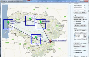
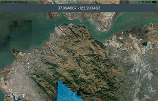
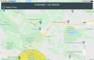
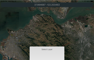
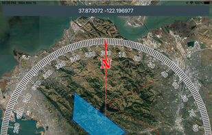
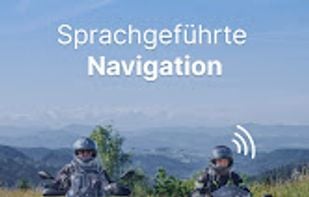
    Kurviger is a motorcycle route planning and navigation app. Curvy and beautiful routes as well as mountains are favored. Cities and highways will be avoided. With Kurviger you can easily find a nice route according to your preferences, from curvy country roads to small back...

    Cost / License

    • Freemium
    • Proprietary

    Application type

    Platforms

    • Online
    • Android
    Kurviger screenshot 1
    Kurviger screenshot 1
    Kurviger screenshot 2
    +7
    Kurviger screenshot 3
  2. GPS navigation app with offline maps, topographic detail, custom waypoints, 650,000+ hiking trails, weather forecasts, public land, and guidebook content.

    Cost / License

    • Paid
    • Proprietary

    Application type

    Platforms

    • Online
    • Android
    • iPhone
    onX Backcountry screenshot 1
    onX Backcountry screenshot 1
    onX Backcountry screenshot 2
    19 alternatives
  3. Route4Me icon
     Like

    Extremely easy-to-use, Route4Me lets you create, share, manage, & drive optimized routes in a matter of seconds. Route4Me provides the worlds most used route sequencing and optimization software for small businesses & enterprises to 32,000+ customers.

    Cost / License

    • Paid
    • Proprietary

    Platforms

    • Android
    • iPhone
    • Android Tablet
    • iPad
    • Software as a Service (SaaS)
    Route4Me screenshot 1
    Route4Me screenshot 1
    Route4Me screenshot 2
    +7
    Route4Me screenshot 3
    7 alternatives
  4. FixPhrase icon
     3 likes

    Sometimes GPS coordinates or street addresses aren't good enough. A FixPhrase is between two and four words that can instantly pinpoint any location on Earth.

    Cost / License

    • Free
    • Open Source

    Application type

    Platforms

    • Online
    • Android
    • iPhone
    • iPad
    • F-Droid
    FixPhrase screenshot 1
    FixPhrase screenshot 1
    FixPhrase screenshot 2
    +3
    FixPhrase screenshot 3
    4 alternatives
  5. Map My Ride icon
     8 likes

    A complete set of tracking & training tools to help you get into running—or just get better at it. Now with personalized Form Coaching tips for Garmin users!.

    Cost / License

    • Freemium
    • Proprietary

    Platforms

    • Android
    • iPhone
    Map My Ride screenshot 1
    Map My Ride screenshot 1
    Map My Ride screenshot 2
    +2
    Map My Ride screenshot 3
    70 alternatives
  6. ATAK-CIV icon
     2 likes

    The Team Awareness Kit (TAK), for civilian uses, or Tactical Assault Kit (also TAK) for military uses is a suite of software that provides geospatial information and allows user collaboration over geography.

    Cost / License

    • Free
    • Open Source

    Application type

    Platforms

    • Android
    ATAK-CIV screenshot 1
    1 alternatives
  7. GMap.NET icon
     11 likes

    GMap.NET is great and Powerful, Free, cross platform, open source .NET control. Enable use routing, geocoding, directions and maps from Google, Yahoo!, Bing, OpenStreetMap, ArcGIS, Pergo, SigPac, Yandex, Mapy.cz, Maps.lt, iKarte.

    Cost / License

    • Free
    • Open Source

    Alerts

    • Discontinued

    Platforms

    • Windows
    • Windows Mobile
    GMap.NET screenshot 1
    GMap.NET screenshot 1
    GMap.NET screenshot 2
    +5
    GMap.NET screenshot 3
    43 alternatives
  8. People Tracker App allows you to stay connected to your employees, friends, family, co-workers... or anyone else you want to locate in real time.

    Cost / License

    • Paid
    • Proprietary

    Platforms

    • iPhone
    • iPad
    People Tracker App screenshot 1
    People Tracker App screenshot 1
    People Tracker App screenshot 2
    +7
    People Tracker App screenshot 3
    47 alternatives
  9. PlanePlotter icon
     4 likes

    PlanePlotter receives and decodes live digital position reports from aircraft and plots them on a chart. You can see a radar-like display of all those aircraft around you broadcasting digital messages including ACARS, ADS-B and HFDL.

    Cost / License

    • Paid
    • Proprietary

    Application type

    Platforms

    • Windows
    PlanePlotter screenshot 1
    PlanePlotter screenshot 1
    PlanePlotter screenshot 2
    +8
    PlanePlotter screenshot 3
    13 alternatives
  10. Mgrs & Utm Map is a GPS and coordinate system application designed to assist military personnel and outdoor enthusiasts with navigation, supporting various satellite systems and offering diverse map layers.

    Cost / License

    • Freemium
    • Proprietary

    Application type

    Platforms

    • iPhone
    • iPad
    • Android
    • Android Tablet
    Mgrs & Utm Map screenshot 1
    Mgrs & Utm Map screenshot 1
    Mgrs & Utm Map screenshot 2
    +5
    Mgrs & Utm Map screenshot 3
    5 alternatives
  11. Trail Explorer is a website and a mobile app to explore any location on the map, discover nearby hiking trails and places of interest, explore outdoor sports opportunities, ChatGPT advice and insights, videos, webcams, the weather, news across 20 categories.

    Cost / License

    • Free
    • Proprietary

    Platforms

    • Online
    • Android
    • iPhone
    • Android Tablet
    • iPad
    Trail Explorer screenshot 1
    Trail Explorer screenshot 1
    Trail Explorer screenshot 2
    +6
    Trail Explorer screenshot 3
    12 alternatives
  12. OpenCPN icon
     4 likes

    OpenCPN is a free software (GPLv2) project to create a concise chart plotter and navigation software, for use underway or as a planning tool.

    Cost / License

    • Free
    • Open Source

    Platforms

    • Mac
    • Windows
    • Linux
    OpenCPN screenshot 1
    5 alternatives
  13. Flitsmeister icon
     1 like

    Flitsmeister is an app that helps you avoid fines, roadworks, traffic jams and accidents while driving. It warns you of speed cameras, speed enforcement zones, roadworks, delays and dangerous situations on the road.

    Cost / License

    • Freemium
    • Proprietary

    Application type

    Platforms

    • Android
    • iPhone
    Flitsmeister screenshot 1
    Flitsmeister screenshot 1
    Flitsmeister screenshot 2
    +3
    Flitsmeister screenshot 3
    9 alternatives
  14. Free GPS navigation app with offline OpenStreetMaps, voice guidance, speed limit and camera alerts, and route planning for over 200 countries.

    Cost / License

    • Freemium
    • Proprietary

    Application type

    Platforms

    • Windows
    • Android
    • iPhone
    • Android Tablet
    • HUAWEI AppGallery
    • iPad
    • Android Auto
    • Kindle Fire
    • Apple Car Play
    MapFactor Navigator screenshot 1
    MapFactor Navigator screenshot 1
    MapFactor Navigator screenshot 2
    +5
    MapFactor Navigator screenshot 3
    27 alternatives
  15. Radarbot icon
     1 like

    The only app that combines real-time alerts with the best offline radar detection alert system. With Radarbot, you will have the best radar alerts, real time traffic alerts and specific speed limit alerts for different vehicles (cars, motorbikes, trucks and commercial vehicles)...

    Cost / License

    • Freemium
    • Proprietary

    Application type

    Platforms

    • Android
    • iPhone
    • iPad
    Radarbot screenshot 1
    Radarbot screenshot 1
    Radarbot screenshot 2
    10 alternatives
  16. Beeline icon
     2 likes

    Ride planning, navigation & GPS tracking for cycling & motorcycling.

    Cost / License

    • Freemium
    • Proprietary

    Application type

    Platforms

    • Android
    • iPhone
    • Android Tablet
    • iPad
    • Online
    Beeline screenshot 1
    Beeline screenshot 1
    Beeline screenshot 2
    +7
    Beeline screenshot 3
    4 alternatives
  17. Wanderu icon
     2 likes

    Wanderu is the simplest way to find and book bus and train travel across North America and Europe. Now you can book the best deals on the go with the official Wanderu app, featured as "Best New App" by the iTunes App Store and Google Play.

    Cost / License

    • Free
    • Proprietary

    Application type

    Platforms

    • Online
    • Android
    • iPhone
    • iPad
    Wanderu screenshot 1
    Wanderu screenshot 1
    Wanderu screenshot 2
    +7
    Wanderu screenshot 3
    19 alternatives
  18. Offline navigation app covering over 100 countries, 3D landmarks, POIs, quick route calculation, junction view, and compact storage for reliable travel.

    Cost / License

    • Paid
    • Proprietary

    Application type

    Platforms

    • Android
    • iPhone
    • iPad
    • Android Tablet
    iGO Navigation screenshot 1
    iGO Navigation screenshot 1
    iGO Navigation screenshot 2
    +3
    iGO Navigation screenshot 3
    46 alternatives
  19. Navmii icon
     8 likes

    Free navigation app with offline maps, live traffic, voice guidance, POI search, walking mode, and driver scoring, available in over 150 countries.

    Cost / License

    • Freemium
    • Proprietary

    Application type

    Platforms

    • Android
    • iPhone
    • Android Tablet
    • iPad
    Navmii screenshot 1
    Navmii screenshot 1
    Navmii screenshot 2
    +2
    Navmii screenshot 3
    32 alternatives