
Affordable, Scalable & Reliable location services since 2013. We proudly serve 100k+ developers who make 2 billion+ requests each day.
Affordable, Scalable & Reliable location services since 2013. We proudly serve 100k+ developers who make 2 billion+ requests each day.

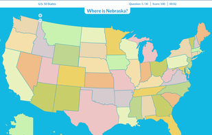
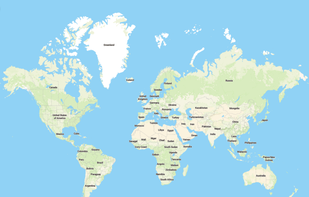
It’s so important to know the world we live in. But it’s so huge! There are so many countries, cities, flags, rivers, seas and more than 7 billions of people. Do everyone know all countries of the world? Probably not :) Some people even don’t know neighboring countries.


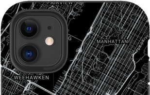
Mapify offers personalized map posters, phone cases and more! Mapify uses a specialized Fine Art printing technique and incredibly large images to ensure your map contains every single detail of your special place.


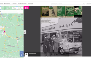
At Historypin we develop and maintain storytelling methods used by 3000+ cultural organisations to expand their communities - and bring their resources to life.

Twice a year the sun aligns with the midtown grid in NYC, days we call, Manhattanhenge. Now you can discover henge events happening all over the city on every sunset of the year!.

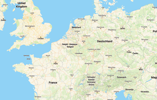
Explore more than 400 000 places in Europe (the rest of the world is coming!). With Wikipedia backed database, TourPickr is the best source of travel information.

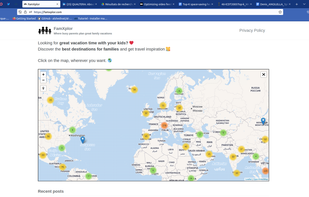
Traveling with kids requires finding friendly activities for all family members. Family travel blogs are a good source of inspiration, but they need lot of search and read. On FamXplor, it's easy to find things to do!

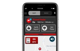
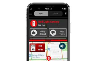
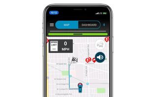
Share and receive real-time alerts from the entire network of users in the Cobra driving community. Instant red light and speed camera as well as live law enforcement detection notifications ensure you can drive smarter and safer.


Jawg Maps provides SaaS Maps Services, such as Maps, Geocoding, Routing and Elevation. It is based on open data sources, like OpenStreetMap or OpenAdresses.


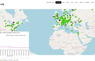
A free worldwide radiation monitoring website. It is a place for experimenters, enthusiats and background radiation monitoring.

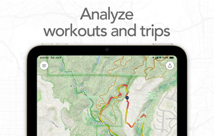
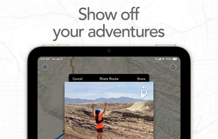
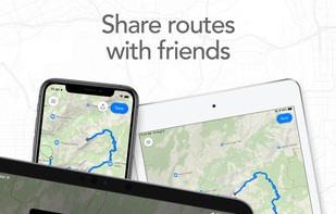
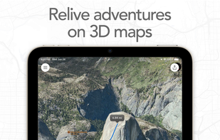
Map routes with your finger and Footpath will snap to roads and trails. Measure distances and elevations in seconds, then navigate along with turn-by-turn directions.


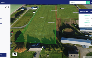
Rasters.io is web solution to integrate personalized maps and IoT. By mixing real-time IoT data and geographic information in decisions, Rasters.io can provide useful information and process and be a part of a more complex solution.

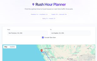
Free rush hour traffic estimator tool. Get accurate traffic forecasts, find optimal driving times, and plan your commute to avoid rush hour congestion. Our traffic estimator analyzes 24-hour patterns to tell you exactly when to leave for the fastest journey.
Bigmap is tool to let you create big maps.
The bigmap service creates maps from the same tiles used for the well-known "slippy maps" (e.g. informationfreeway.org). Resulting maps are less suitable for online browsing, but better for printing.

Chart your course to yard sale treasure! Finding yard sales near you has never been more fun and easy!
XTherion is an application that serves as a graphical front end for Therion. Therion itself works entirely with text-based files, but much of the data needs to be generated graphically, so XTherion is one example of how it might be done. It is written in Tcl/Tk.

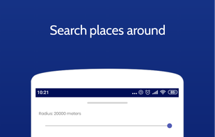
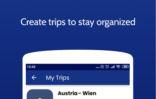
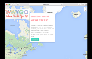
WWYGO is a fun and free way to gather suggestions for your trip from your own friends.

M.App Enterprise Mobile App enables you to connect your mobile device to your M.App Enterprise on-premise installation. It provides you rich workflows to browse and modify your GIS data online and offline.


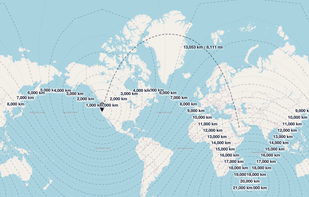
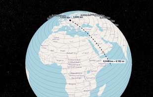
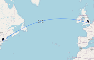
GeoUtil.com is a free, browser-based map and geography toolkit. Measure distances and areas, convert coordinates, optimize GeoJSON/TopoJSON, and visualize spatial data — all quickly, accurately, and without installing any software.

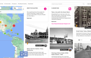
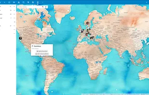
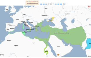
The website offers a world map of every year in history from 3000 BC up until the present, showing every nation, civilization, empire and culture that is known to have existed in each given year (BC dates are determined with a minus sign).

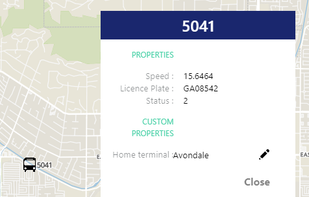
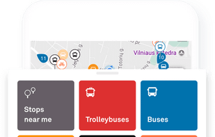
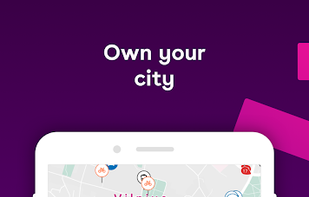
Trafi connects and compares your favorite city mobility options and always shows them in real-time.


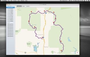
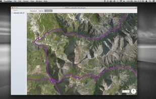
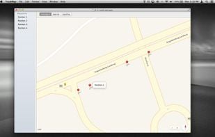
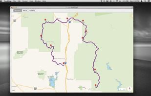
TrackMap lets you quickly and easily visualize your GPX tracks and waypoints on a map. It has a small and intuitive interface that stays out of your way and lets you focus on the map. The collapsible sidebar contains a list of all the waypoints and tracks included in the file...