Map Services Page 13 of 14

All apps in Map Services category. Use the filters below to narrow down your search. 

Popular filters:

Copy a direct link to this comment to your clipboard
  1. Hoodmaps icon
     Like

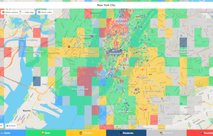
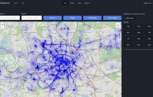
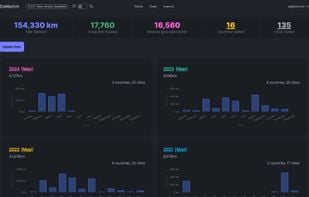
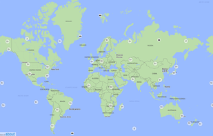
    Hoodmaps is a crowdsourced map to divide cities up into hipsters, tourists, rich, normies, suits, and university areas. Maps of city neighborhood by millions of people around the world. Avoid the tourist traps and navigate cities' hip and alternative areas.

    Cost / License

    • Free
    • Proprietary

    Application type

    Platforms

    • Online
    Hoodmaps screenshot 1
    1 alternatives
  2. The Openstreetmap Contributor app allows anyone to contribute to OSM. It enables those-who-know to easily manage a group of newbies as the contribution process is intuitive and easy. Bring your MapParties to a whole new level!.

    Cost / License

    Application type

    Platforms

    • Android
    13 alternatives
  3. Anyplace icon
     Like

    Anyplace is a first-of-a-kind GPS-less localization and navigation service working in indoor and outdoor space using ordinary smartphones. It has been developed by researchers and students at the Data Management Systems Laboratory (DMSL), Department of Computer Science and the...

    Cost / License

    • Free
    • Open Source (MIT)

    Application type

    Alerts

    • Discontinued

    Platforms

    • Online
    • Android
    • Windows Phone
    Anyplace screenshot 1
    9 alternatives
  4. Topo GPS icon
     Like

    Topo GPS is an app that turns your smartphone in a full feature GPS device with topographic maps that are offline available. In Topo GPS you can easily create waypoints, enter, scan, and view coordinates, measure distances and angles, and record, plan and generate routes and...

    Cost / License

    • Freemium
    • Proprietary

    Platforms

    • Android
    • iPhone
    • Android Tablet
    • iPad
    • Apple Watch
    Topo GPS screenshot 1
    Topo GPS screenshot 1
    Topo GPS screenshot 2
    +7
    Topo GPS screenshot 3
    7 alternatives
  5. OkMap icon
     Like

    OkMap is an interactive software which allows you to work on your computer screen with web maps or digital maps that you have either bought or scanned.

    Cost / License

    • Freemium
    • Proprietary

    Application type

    Platforms

    • Windows
    • iPhone
    • iPad
    5 alternatives
  6. AwayTake icon
     Like

    Location based restaurant food price, food rating & distance comparison and navigation by car, on foot, transit and bike in 41 countries. Just write hamburger, share/pin your location and list all hamburgers around; compare, select one and navigate.

    Cost / License

    • Free
    • Proprietary

    Platforms

    • Online
    • Android
    • Android Tablet
    AwayTake screenshot 1
    AwayTake screenshot 1
    AwayTake screenshot 2
    +2
    AwayTake screenshot 3
    16 alternatives
  7. Aakashe icon
     Like

    Aakashe is an instant drone imagery platform based in India. The subscription-based solution provides high-resolution aerial data to customers in infrastructure, urban planning, and real estate sectors.

    Cost / License

    • Paid
    • Proprietary

    Application type

    Platforms

    • Online
    • Software as a Service (SaaS)
    Efficient Land Acquisition: Aakashe provides high-resolution aerial imagery, enabling quick and accurate assessment of land parcels for potential acquisition.
Cost-effective Analysis: Reduce the time and cost associated with traditional land surveys by utilizing Aakashe’s instant & precise drone imagery.
    Enhanced Enforcement: Identify and monitor unauthorized land use or encroachments.
Preventive Measures: Facilitate swift legal and administrative action against encroachments through accurate and latest imagery and Implement effective strategies to prevent future encroachments based on comprehensive land data.
    Smart Urban Planning: Utilize Aakashe’s detailed aerial imagery to design and plan urban infrastructure with greater precision and efficiency
Data-Driven Decisions: Make informed decisions on zoning, land use, and resource allocation using accurate visual data.
    +2
    Sustainable Urban Forestry: Monitor and manage urban forests effectively with Aakashe’s high-resolution images, supporting biodiversity and green spaces.
Resource Optimization: Optimize resources and efforts in maintaining urban forestry with precise data on tree coverage and health.
    7 alternatives
  8. GeoSheets icon
     Like

    GeoSheets is a free add-on for Google Spreadsheets that makes it simple to do lightweight GIS tasks like geocoding, address normalization, distance calculations and creating customized and embeddable maps.

    Cost / License

    • Freemium
    • Proprietary

    Application types

    Platforms

    • Online
    • Google Drive
    GeoSheets screenshot 1
    GeoSheets screenshot 1
    GeoSheets screenshot 2
    +1
    GeoSheets screenshot 3
    32 alternatives
  9. Doozyrama icon
     1 like

    Crowdsourcing account-based interactive mobile map. All places are added by people without pre-moderation. Places quality is determined by voting (like on Reddit, low rated places are hidden). Ability to see places from chosen contributors.

    Cost / License

    • Free
    • Proprietary

    Platforms

    • iPhone
    • iPad
    Doozyrama screenshot 1
    Doozyrama screenshot 1
    Doozyrama screenshot 2
    +1
    Doozyrama screenshot 3
    12 alternatives
  10. Maperitive is a FREE desktop application for drawing maps based on OpenStreetMap and GPS data. You can define what gets on the map and how it is painted. You can also export these maps into bitmaps and SVG files and print them.

    Cost / License

    • Free
    • Proprietary

    Application type

    Platforms

    • Windows
    • Linux
    • Wine
    Maperitive screenshot 1
    Maperitive screenshot 1
    Maperitive screenshot 2
    1 alternatives
  11. Picsplore icon
     Like

    Picsplore is a brand new location based social network! We want to show you what’s new and exciting around you, it could be a band playing at a dive bar, a carnival, a house party, the possibilities are truly endless.

    Cost / License

    • Free
    • Proprietary

    Platforms

    • iPhone
    Picsplore screenshot 1
    Picsplore screenshot 1
    Picsplore screenshot 2
    29 alternatives
  12. Safecast is an international volunteer driven non-profit organization whose goal is to create useful, accessible, and granular environmental data including ionizing radiation. All Safecast data is published, free of charge, into the public domain under a CC0 designation.

    Cost / License

    • Free
    • Proprietary

    Application type

    Platforms

    • Online
    Map of ionizing radiation from Chernobyl
  13. GPSy icon
     Like

    GPSy is a sophisticated Mac GPS communications and GIS mapping program. GPSy connects your Mac to a broad range of Global Positioning System (GPS) navigational units and has advanced mapping, logging, and data transfer features.

    Cost / License

    • Free
    • Proprietary

    Application type

    Platforms

    • Mac
    GPSy screenshot 1
    GPSy screenshot 1
    4 alternatives
  14. xMap AI icon
     Like

    xMap is an AI-powered location intelligence platform that enables users to ask geospatial questions in natural language, such as “Where should I open a new gym with low competition and high Gen Z population?”, and receive instant, visual answers.

    Cost / License

    • Freemium
    • Proprietary

    Application type

    Platforms

    • Online
    Major Food Brands on xMap
    Demographics data on xMap
    Demographic details of an area in USA
    +2
    Competitors Mapping in xMap
    4 alternatives
  15. Alpi Maps icon
     Like

    Offline mapping for hiking with customizable styles, overlays, and HD maps, GPS location tracking, marker management, and complete offline access for iOS and Android.

    Cost / License

    • Free
    • Open Source (MIT)

    Application type

    Platforms

    • iPhone
    • iPad
    • Android
    • Android Tablet
    Alpi Maps screenshot 1
    Alpi Maps screenshot 1
    Alpi Maps screenshot 2
    +2
    Alpi Maps screenshot 3
    11 alternatives
  16. Fast quick optimized driving directions delivery route planning software website for multiple locations stops and single or multiple delivery vehicles. Find the best route with Speedy Route.

    Cost / License

    • Paid
    • Proprietary

    Application type

    Platforms

    • Online
    7 alternatives
  17. MapSphere icon
     Like

    MapSphere is a manageable way to view and organize geographical data of different kind. This might be raster maps and satellite imagery from various sources, your own information received from GPS, tracks of your friends, whatever you want.

    Cost / License

    • Free
    • Proprietary

    Application type

    Platforms

    • Windows
    MapSphere screenshot 1
    MapSphere screenshot 1
    40 alternatives